
Pricing and plans
EIMAR is sold as a monthly subscription to one county or one state. All prices are in US dollars.
Free
For trying the web map
$0
Requires a free account.
- Web map of every published state
- One filter in one county per day; a range counts as one filter
- Matching parcels shown on the map
- No downloads or map images
County
For work in one county
$50 / month
The same price for every county.
- Unlimited queries in the county
- Unlimited parcel lists, with no row limit
- Downloads in CSV or GeoJSON, with every attribute for each parcel
- 100 map images a day
- Data updates published during the subscription
State
For statewide work
Up to $400 / month
$50 for each county in the state, at most $400. Price of each state
- Everything in County, for every county in the state
- 500 map images a day
Government
For state and local government agencies
By contract
Terms are agreed in writing.
- Access in every published state
- Accounts for the staff you name
- Delivery formats and update schedule set in the contract
Compare plans
| Feature | Free | County | State |
|---|---|---|---|
| Area | |||
| Area covered | One county per day | One county | Every county in one state |
| Web map | Yes | Yes | Yes |
| Queries and lists | |||
| Filters | One filter per day | Unlimited | Unlimited |
| Search by address or parcel number | Yes | Yes | Yes |
| Parcel list downloads | No | Unlimited, no row limit | Unlimited, no row limit |
| File formats | — | CSV, GeoJSON | CSV, GeoJSON |
| Columns in each list | — | Parcel ID, situs address, acreage and land use; owner name and mailing address where the county’s licence allows them; then every earth observation measurement with its coverage flag | |
| Map images | |||
| Map images per day | None | 100 | 500 |
| Image files | — | A 1600 × 1200 PNG map and a PDF profile for each parcel | |
| Data | |||
| Earth observation products | Land cover, forest, carbon, crops, soil, water and waterfront, wetland, flood and storm hazard, wildfire and burned area, vegetation loss, ground failure, solar, air quality and climate. Data catalog | ||
| Updates during the subscription | — | Included | Included |
| Billing | |||
| Price | $0 | $50 a month | $50 per county a month, at most $400 |
| Billing period | — | Monthly | Monthly |
| Cancellation | — | At any time from your account page; access continues to the end of the month already paid | |
Price of each state
A state subscription costs $50 for each county in the state, up to $400 a month. A county subscription costs $50 a month in every state.
| State | Counties | Parcels | State subscription, per month |
|---|---|---|---|
| Connecticut | 9 | 1,320,660 | $400 |
| District of Columbia | 1 | 137,400 | $50 |
| Florida | 67 | 10,831,923 | $400 |
| Maryland | 24 | 2,288,646 | $400 |
| Massachusetts | 14 | 2,559,319 | $400 |
| Montana | 56 | 921,301 | $400 |
| New Jersey | 21 | 3,481,240 | $400 |
| Washington | 39 | 3,321,715 | $400 |
| Wisconsin | 72 | 3,574,631 | $400 |
Connecticut is counted by its nine planning regions, which replaced its counties in Census Bureau geography in 2022. More states are in production; each one is added to this table when it is published.
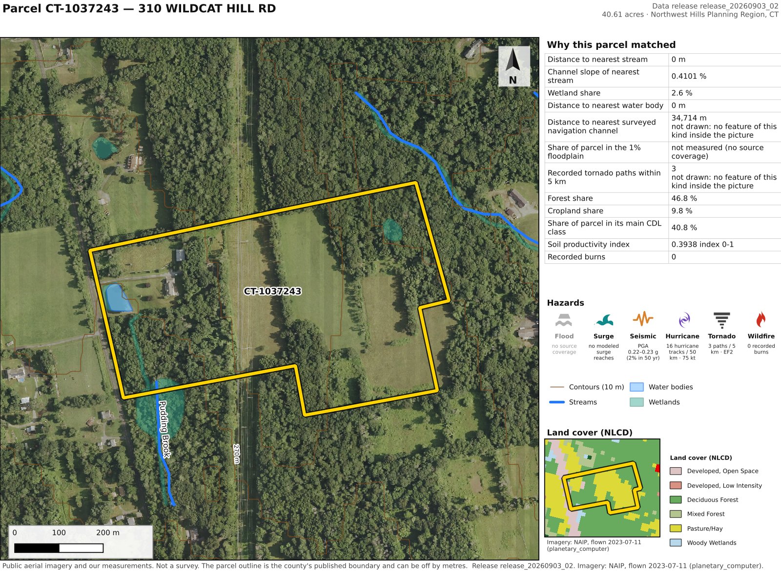
What a map image contains
One map image covers one parcel. Each is delivered as two files:
- A 1600 × 1200 PNG map: the parcel outline over aerial imagery, with streams, wetlands, contours and hazard areas, a land cover inset, a legend, a scale bar and a north arrow
- A PDF profile listing the parcel’s measured values
The daily allowance counts the images ordered in the last 24 hours. Unused images do not carry over.
Billing and access questions
How is a subscription billed?
Monthly, by card, through Stripe, starting on the day you subscribe. We do not store your card number. A subscription renews each month at the price then published for its area; we give at least 30 days’ notice before a renewal that costs more than the last one.
How do I cancel?
From your account page, at any time. The subscription ends at the end of the month already paid, and access continues until then.
What happens to downloaded data when a subscription ends?
Your licence to the data ends with the subscription. Within 30 days you must stop using and delete the data and anything derived from it. You may keep reports and maps already delivered to your own clients, and copies the law requires you to keep. To keep data after a subscription ends, write to us before it ends.
Can I subscribe to more than one area?
Yes. One account can hold several subscriptions, for example two counties in different states. A subscription cannot be bought for an area another of your subscriptions already covers.
Does a subscription include future updates?
Yes. A subscription covers everything we publish inside its area while it is paid for, including updated data and newly added attributes.
Can I use the data in work for my clients?
With a state subscription, you may include the data in reports, maps, plans and model outputs you deliver to your own clients, including government clients. A table of records inside a deliverable may hold at most 1,000 records.
Do you offer national coverage, redistribution rights or use inside another application?
These are arranged by written agreement. Contact support@ikonengeospatial.com.
Do you sell to government agencies?
Yes, by contract rather than by card. See government access.
Try the web map before you subscribe
Create a free account to filter parcels in any published county and see the results on the map.
Open the web map Contact sales